


Voting District 1175, Tarrant County, Texas
About
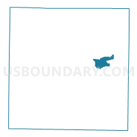
Outline

Summary
| Unique Area Identifier | 677156 |
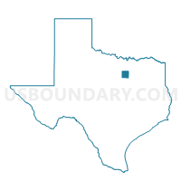
| Name | Voting District 1175 |
| County | Tarrant County |
| State | Texas |
| Area (square miles) | 7.80 |
| Land Area (square miles) | 7.29 |
| Water Area (square miles) | 0.51 |
| % of Land Area | 93.44 |
| % of Water Area | 6.56 |
| Latitude of the Internal Point | 32.79775570 |
| Longtitude of the Internal Point | -97.14765350 |
Maps

Graphs
Select a template below for downloading or customizing gragh for Voting District 1175, Tarrant County, Texas


Neighbors
Neighoring Voting District (by Name) Neighboring Voting District on the Map
- Voting District 1380, Tarrant County, TX
- Voting District 1388, Tarrant County, TX
- Voting District 1420, Tarrant County, TX
- Voting District 1437, Tarrant County, TX
- Voting District 1490, Tarrant County, TX
- Voting District 1547, Tarrant County, TX
- Voting District 1560, Tarrant County, TX
- Voting District 1615, Tarrant County, TX
- Voting District 2228, Tarrant County, TX
- Voting District 3139, Tarrant County, TX
- Voting District 3160, Tarrant County, TX
- Voting District 3176, Tarrant County, TX
- Voting District 3197, Tarrant County, TX
- Voting District 3212, Tarrant County, TX
- Voting District 3213, Tarrant County, TX
- Voting District 3247, Tarrant County, TX
- Voting District 3409, Tarrant County, TX
- Voting District 3414, Tarrant County, TX
- Voting District 3442, Tarrant County, TX
- Voting District 3445, Tarrant County, TX
- Voting District 3564, Tarrant County, TX
- Voting District 3590, Tarrant County, TX
Top 10 Neighboring County Subdivision (by Population) Neighboring County Subdivision on the Map
- Fort Worth CCD, Tarrant County, TX (791,745)
- Northeast Tarrant CCD, Tarrant County, TX (525,576)
- Arlington CCD, Tarrant County, TX (491,713)
Top 10 Neighboring Place (by Population) Neighboring Place on the Map
- Fort Worth city, TX (741,206)
- Arlington city, TX (365,438)
- Euless city, TX (51,277)
- Hurst city, TX (37,337)
Top 10 Neighboring Unified School District (by Population) Neighboring Unified School District on the Map
- Fort Worth Independent School District, TX (466,910)
- Arlington Independent School District, TX (341,201)
- Hurst-Euless-Bedford Independent School District, TX (137,578)
Top 10 Neighboring State Legislative District Lower Chamber (by Population) Neighboring State Legislative District Lower Chamber on the Map
- State House District 93, TX (179,024)
- State House District 91, TX (164,484)
- State House District 95, TX (155,511)
- State House District 92, TX (154,749)
- State House District 94, TX (143,509)
Top 10 Neighboring State Legislative District Upper Chamber (by Population) Neighboring State Legislative District Upper Chamber on the Map
- State Senate District 12, TX (1,013,641)
- State Senate District 10, TX (834,265)
- State Senate District 9, TX (807,907)
Top 10 Neighboring 111th Congressional District (by Population) Neighboring 111th Congressional District on the Map
- Congressional District 26, TX (915,137)
- Congressional District 6, TX (809,095)
- Congressional District 24, TX (792,319)
Top 10 Neighboring Census Tract (by Population) Neighboring Census Tract on the Map
- Census Tract 1065.10, Tarrant County, TX (8,129)
- Census Tract 1065.17, Tarrant County, TX (7,387)
- Census Tract 1134.05, Tarrant County, TX (5,975)
- Census Tract 1134.08, Tarrant County, TX (5,424)
- Census Tract 1135.14, Tarrant County, TX (5,020)
- Census Tract 1136.19, Tarrant County, TX (4,677)
- Census Tract 1131.02, Tarrant County, TX (4,575)
- Census Tract 1131.08, Tarrant County, TX (4,400)
- Census Tract 1065.09, Tarrant County, TX (4,019)
- Census Tract 1131.14, Tarrant County, TX (3,899)
Top 10 Neighboring 5-Digit ZIP Code Tabulation Area (by Population) Neighboring 5-Digit ZIP Code Tabulation Area on the Map
- 76053, TX (28,421)
- 76040, TX (27,524)
- 76012, TX (25,689)
- 76006, TX (22,639)
- 76120, TX (15,283)
- 76118, TX (13,866)